Log in
All resources
Create a design
38,207 Free Images of 1860 Maps
maps in the library of congress
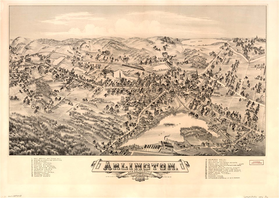
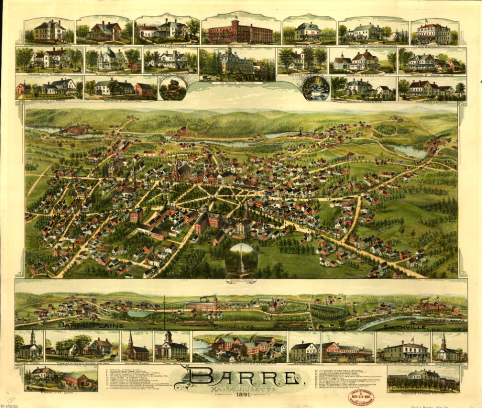
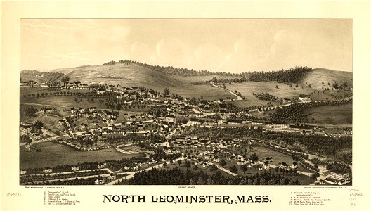
massachusetts
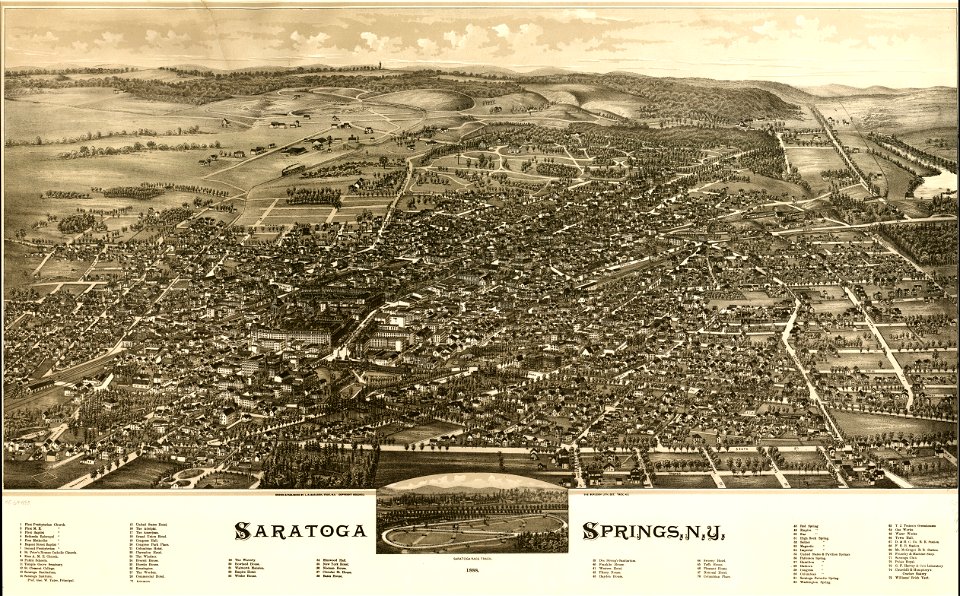
o. h. bailey
charts and maps of the royal museums greenwich
old maps of massachusetts
1682 maps
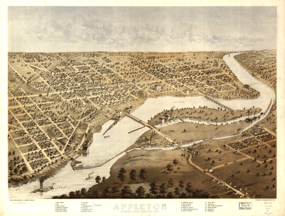
albert ruger
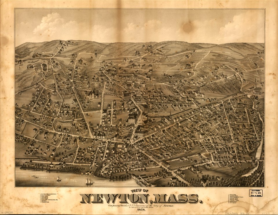
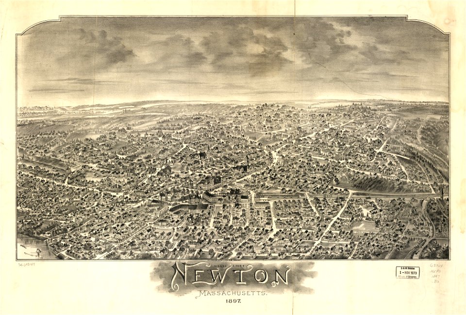
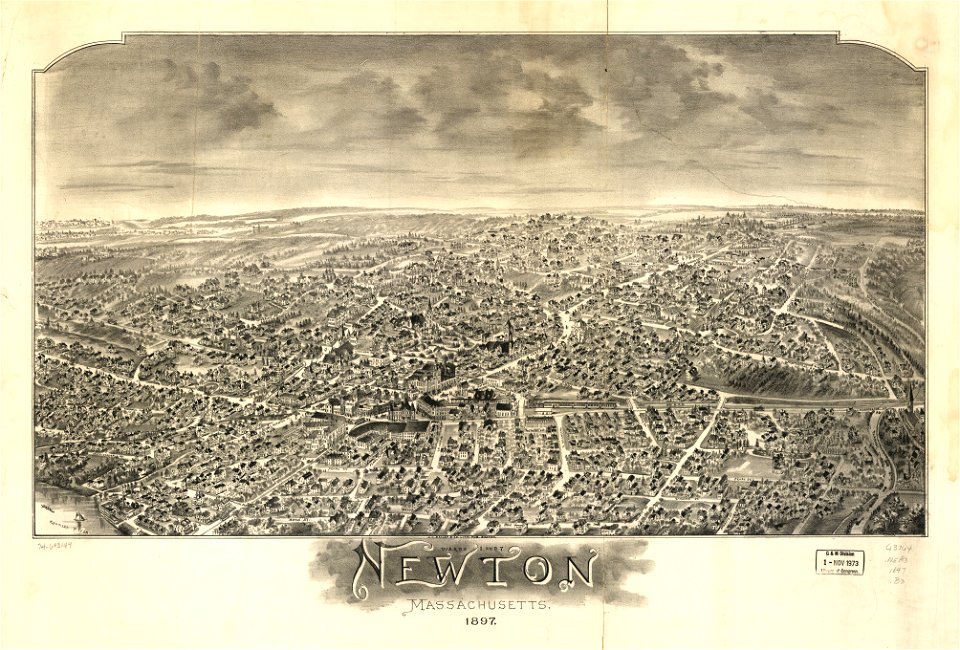
maps of newton
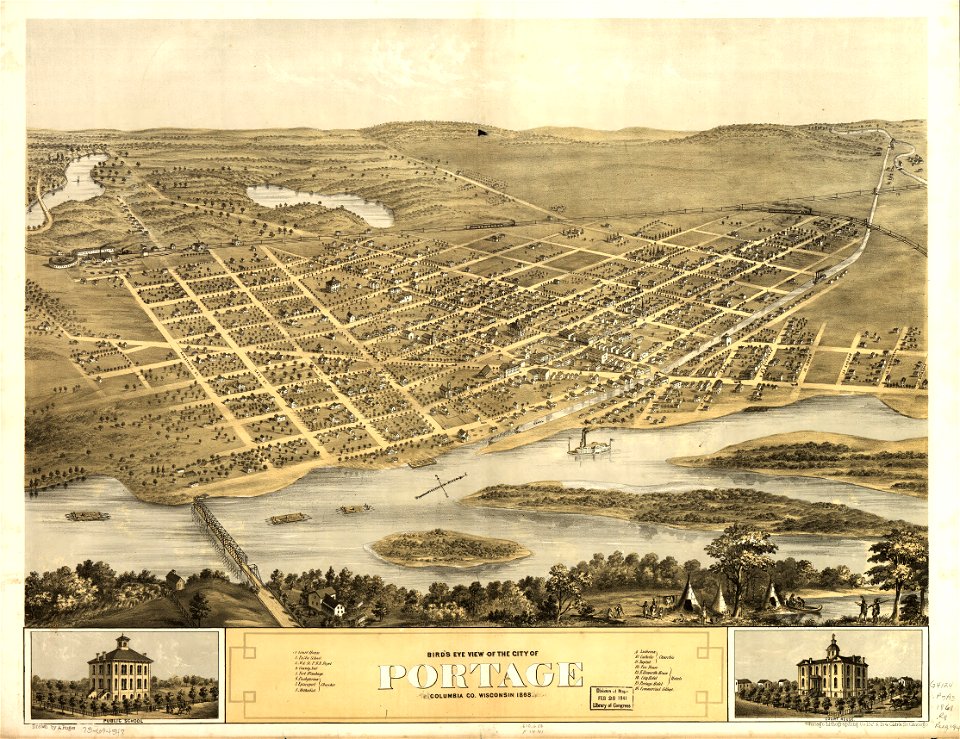
town maps by l. r. burleigh
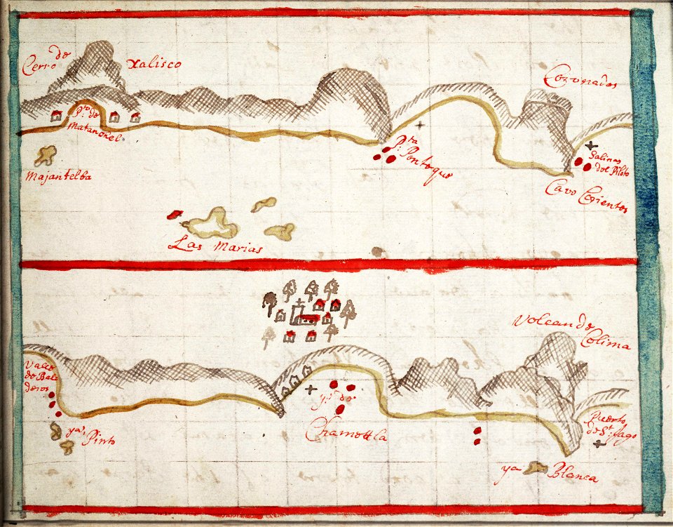
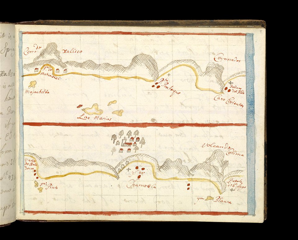
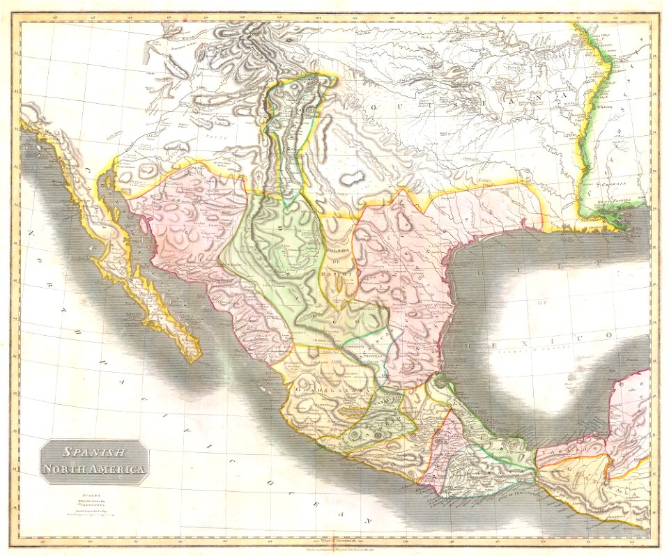
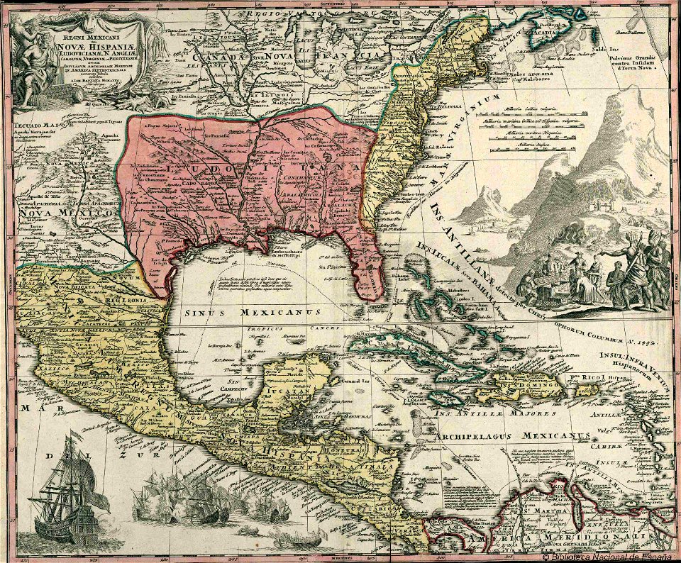
old maps of mexico
old maps of mexico
jalisco
old maps of mexico
jalisco
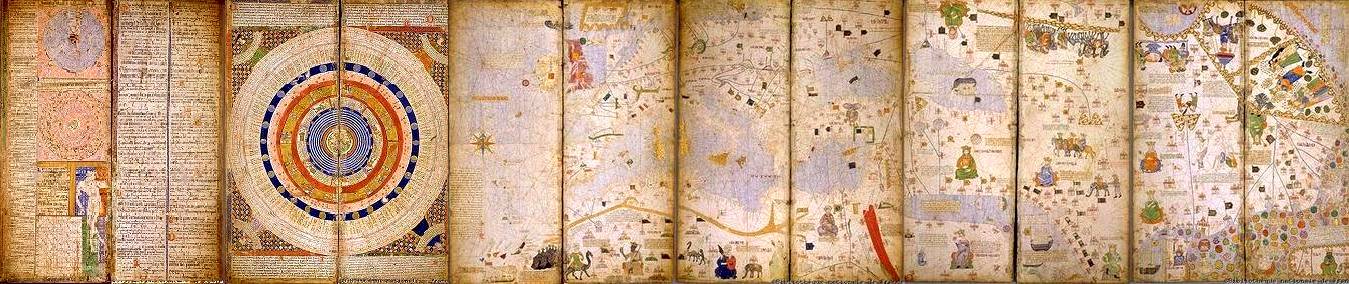
old celestial maps
maps with figures
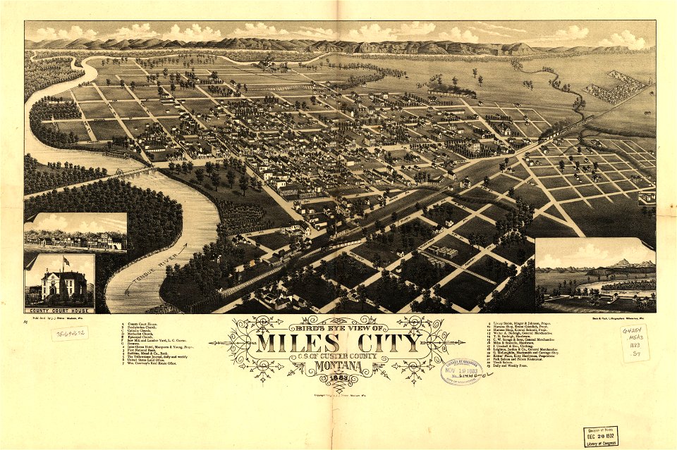
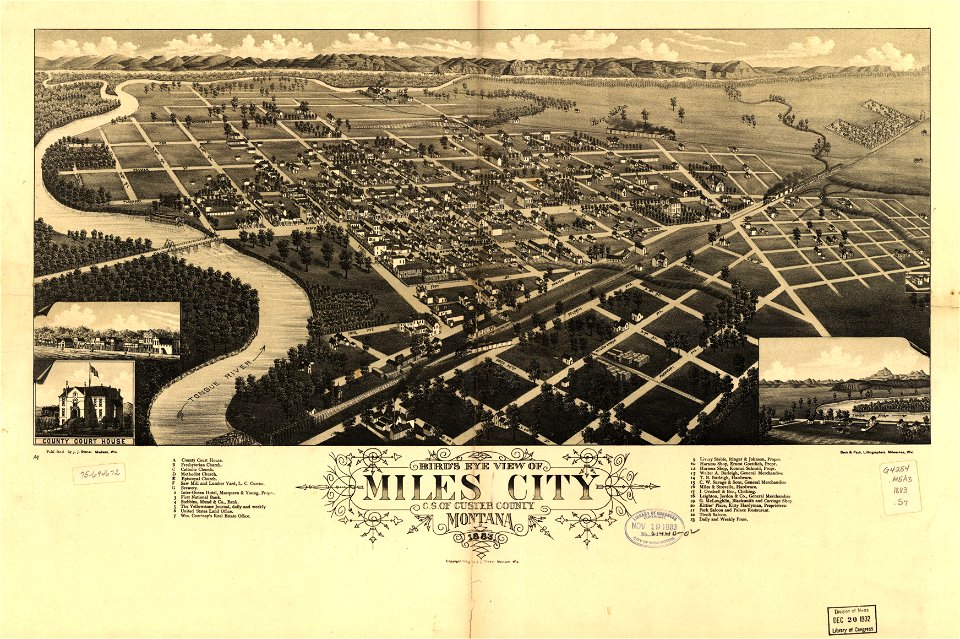
miles city
montana
maps in the library of congress
washington
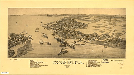
cedar key
florida
maps in the library of congress
albert ruger
miles city
montana
cedar key
florida
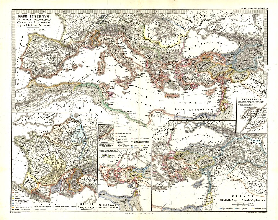
19th-century maps of the mediterranean sea
1865 maps
19th-century maps of the mediterranean sea
1865 maps
maps from the mechanical curator collection
1868 maps
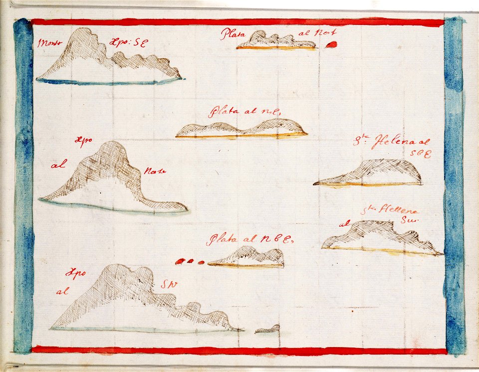
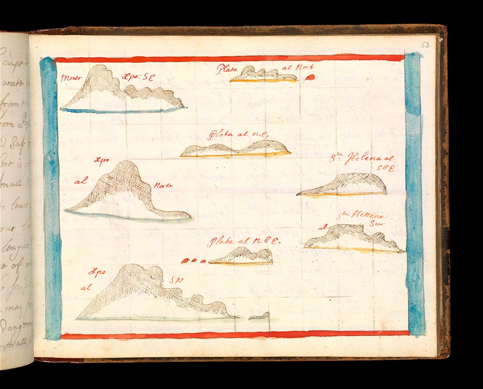
thomas abernethy (explorer)
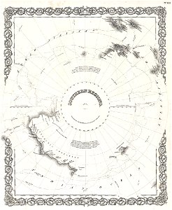
old maps of antarctica
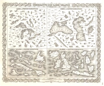
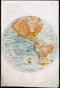
geographic comparison diagrams
1855 maps
geographic comparison diagrams
1855 maps
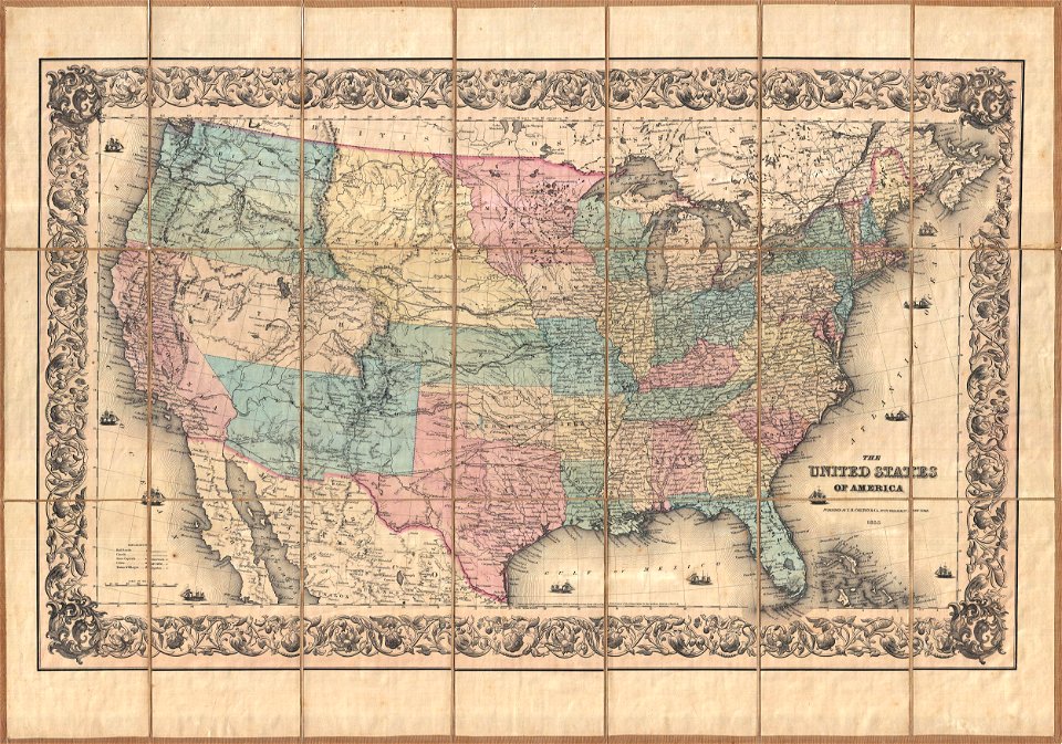
maps by joseph hutchins colton
english-language maps
pleasant hill
missouri
massachusetts
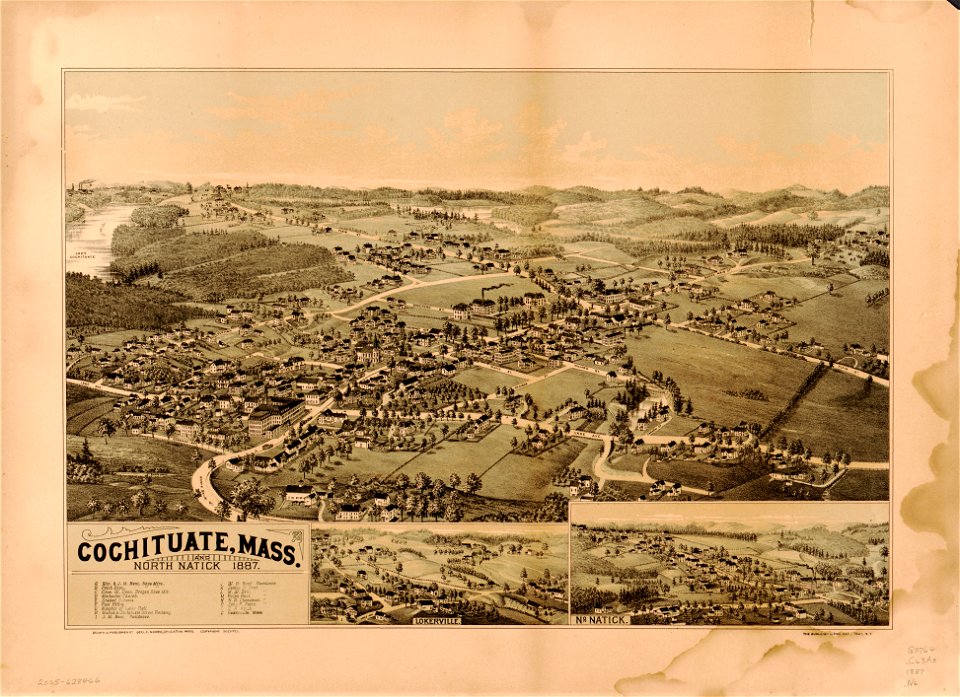
natick
massachusetts
natick
old maps of new york (state)
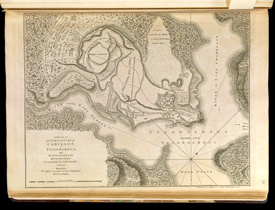
fort ticonderoga
19th-century satirical maps
1870 maps of europe
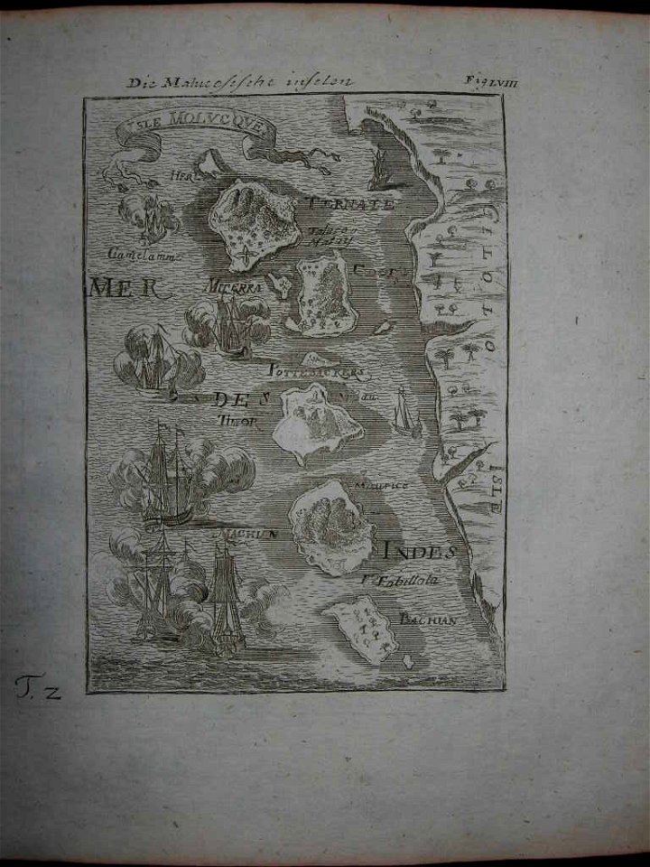
17th-century maps of indonesia
1665
maps by nicolas sanson
1705
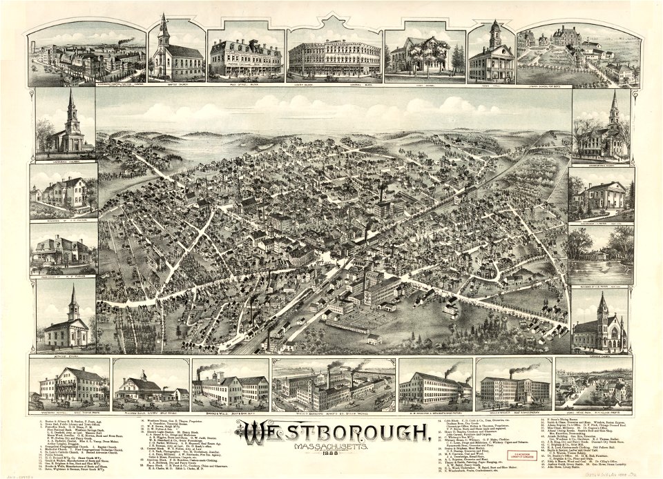
massachusetts
o. h. bailey
maps in the library of congress
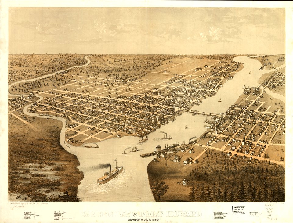
1867 maps
1810s maps of mexico
1814 in mexico
1375 maps of africa
catalan atlas
old maps of massachusetts
o. h. bailey
old maps of massachusetts
o. h. bailey
maps by frederick de wit
copper engraving
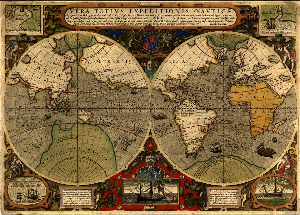
francis drake
1577
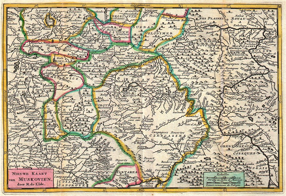
old maps of the russian empire
johannes ratelband
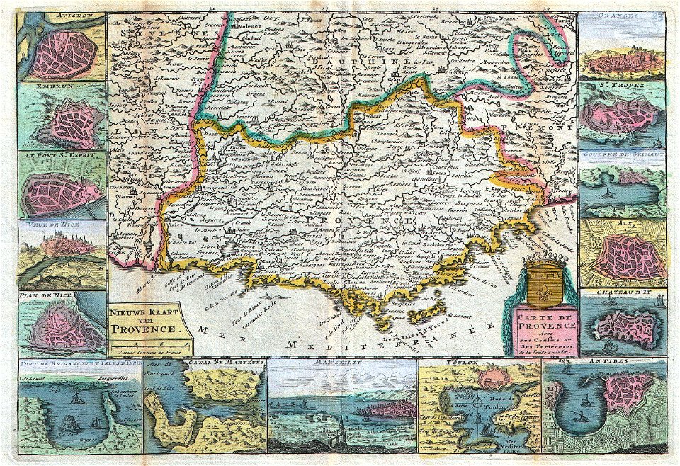
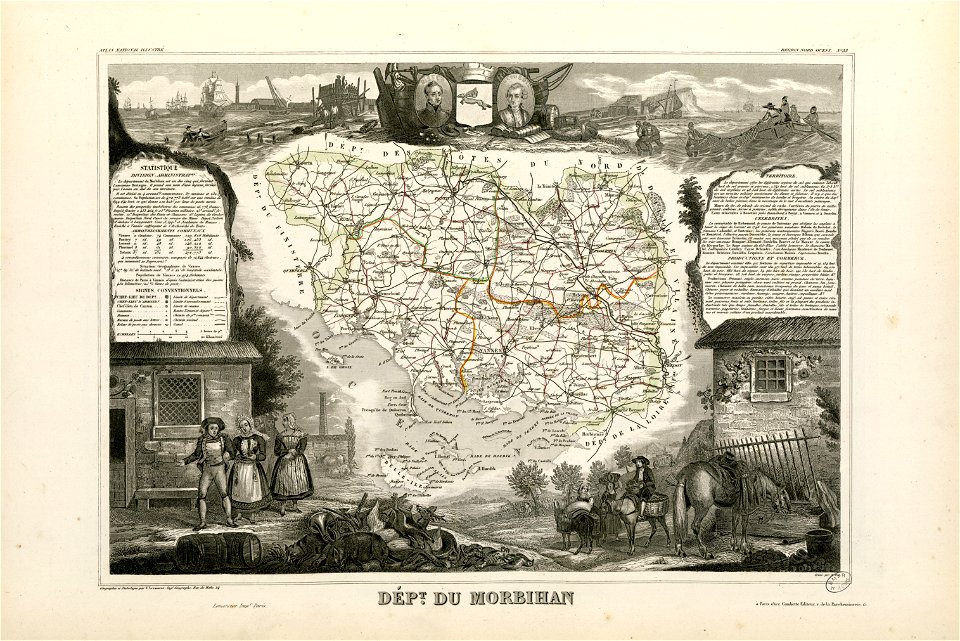
old maps of provence
johannes ratelband
maps in the library of congress
washington
charts and maps of the royal museums greenwich
1572 maps
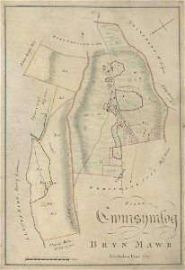
estate maps in the national library of wales
estate maps
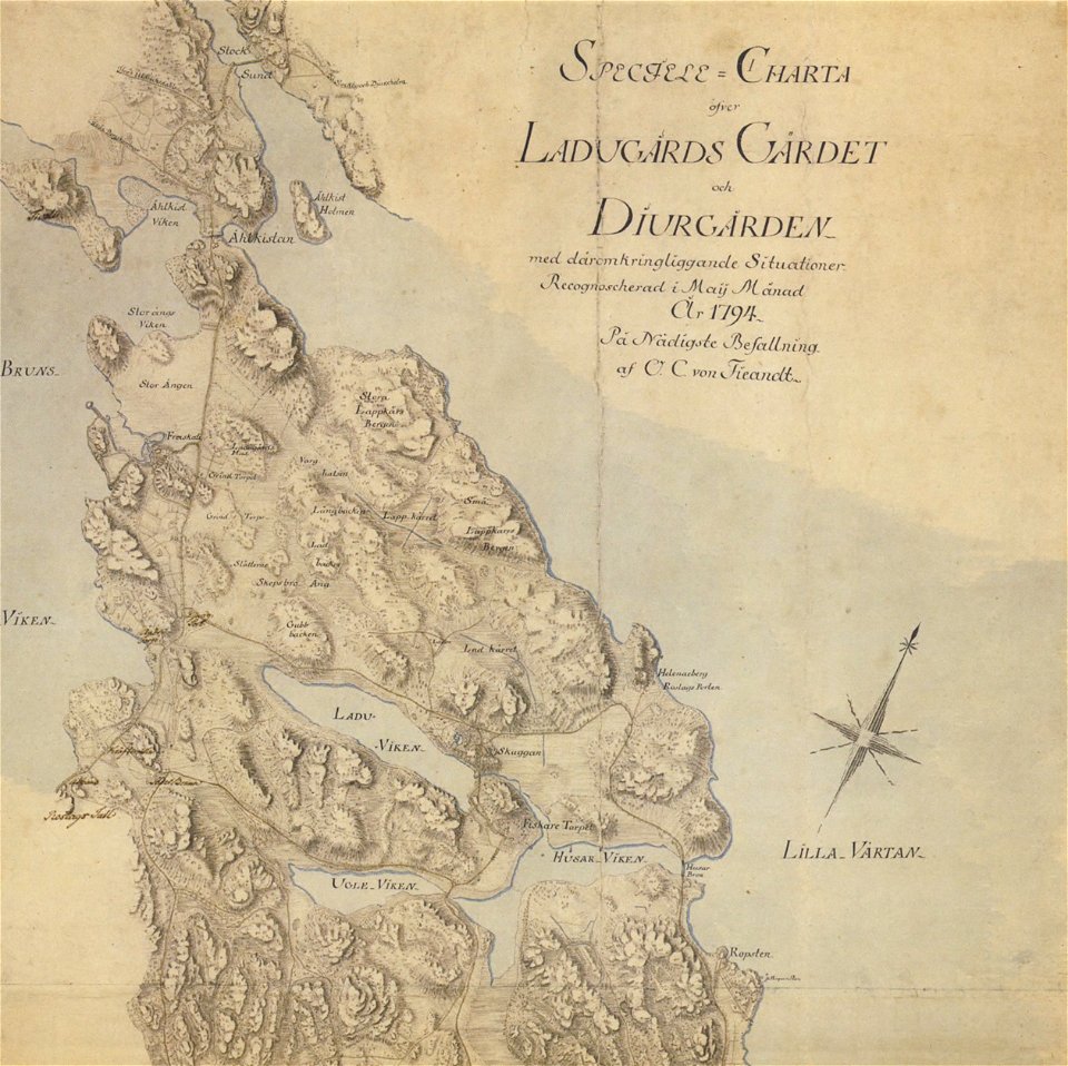
18th-century maps of stockholm
maps of gärdet
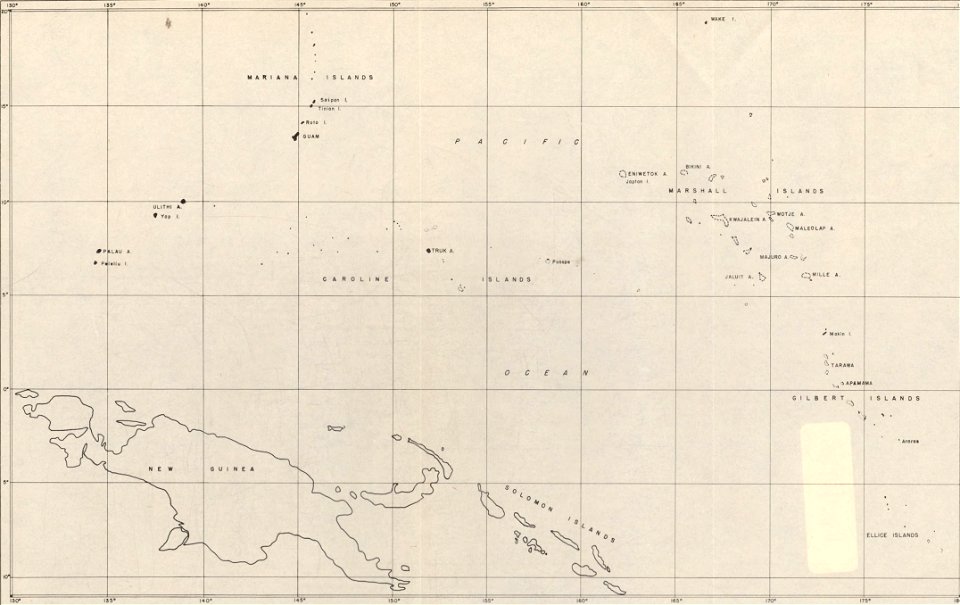
maps of islands of the pacific ocean
old maps of the pacific ocean
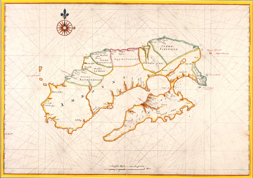
17th-century maps of indonesia
description de l'universe
18th-century maps of indonesia
description de l'universe
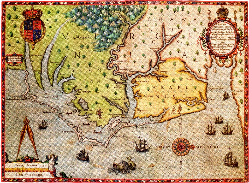
old maps of virginia
theodor de bry
charts and maps of the royal museums greenwich
old maps of ecuador
charts and maps of the royal museums greenwich
old maps of ecuador
massachusetts
o. h. bailey
massachusetts
o. h. bailey
massachusetts
o. h. bailey
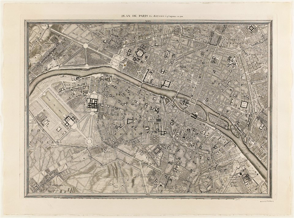
maps of paris from paris musées
plan de roussel
old maps of panama
panama
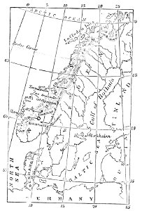
maps of scandinavia
1877 maps
maps in the library of congress
town maps by l. r. burleigh
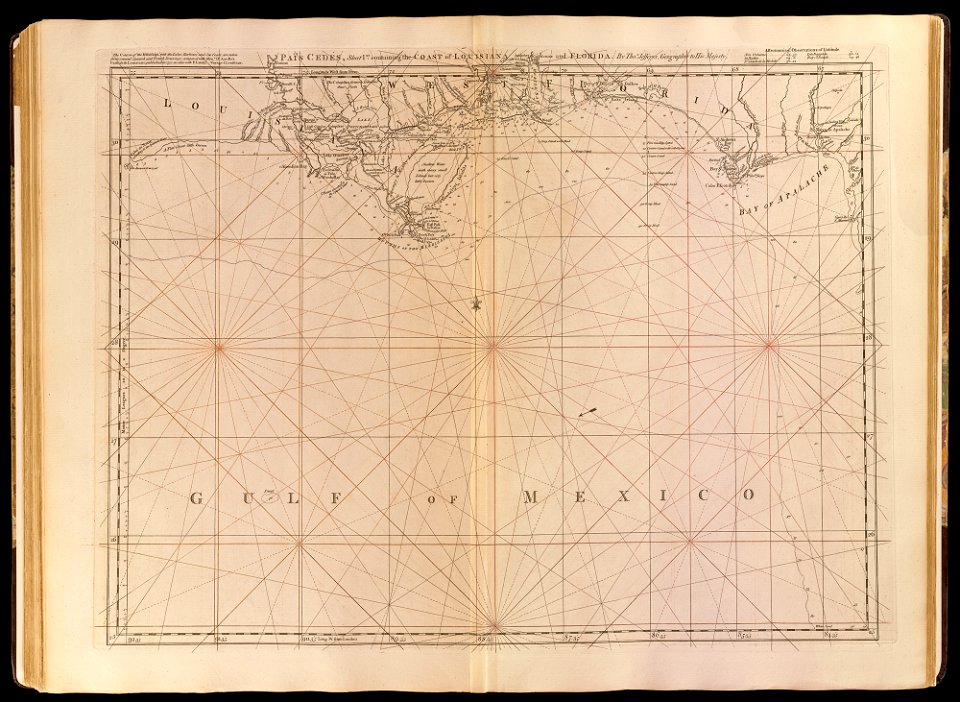
old maps of the gulf of mexico
maps by thomas jefferys
maps in the library of congress
a. hoen & co.
maps in the library of congress
a. hoen & co.
maps in the library of congress
1867 maps
massachusetts
o. h. bailey
massachusetts
o. h. bailey
old manuscript maps
pictorial maps
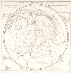
old maps of earth's hemispheres
pictorial maps
1780 maps of pennsylvania
1780 maps of new jersey
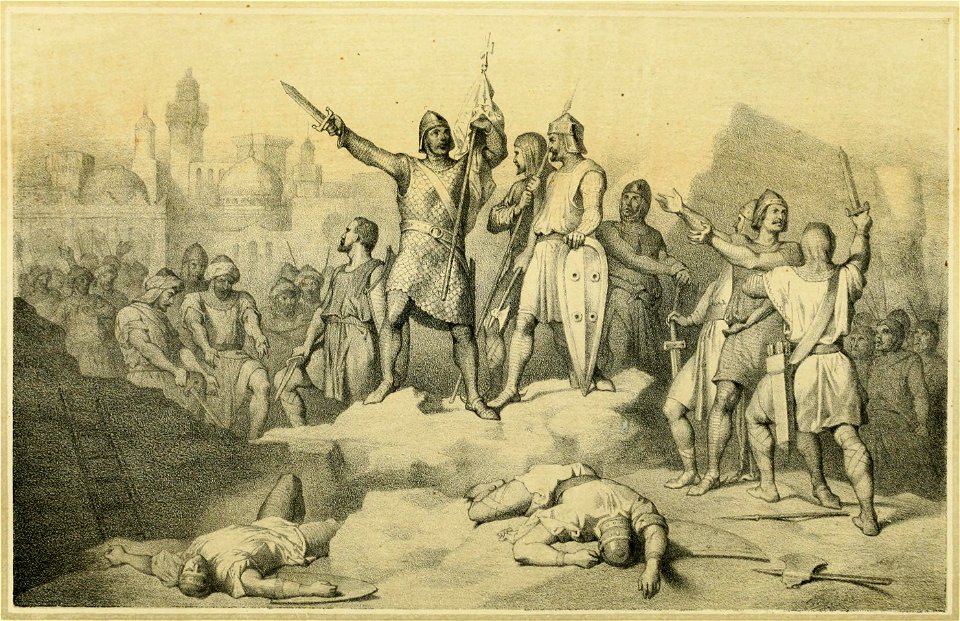
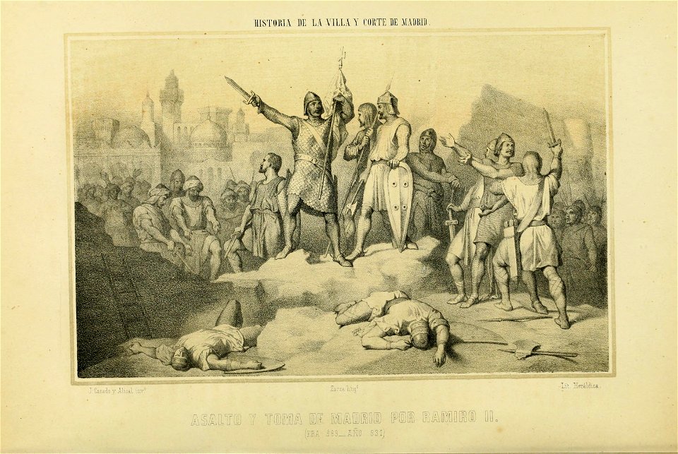
historia de la villa y corte de madrid (1860-1864)
eusebio zarza
historia de la villa y corte de madrid (1860-1864)
eusebio zarza
longboat
davit
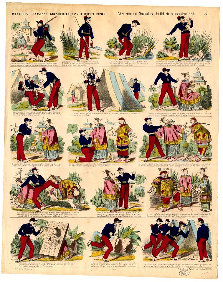
collections of the bibliothèques-médiathèques de metz
limédia galeries - chine
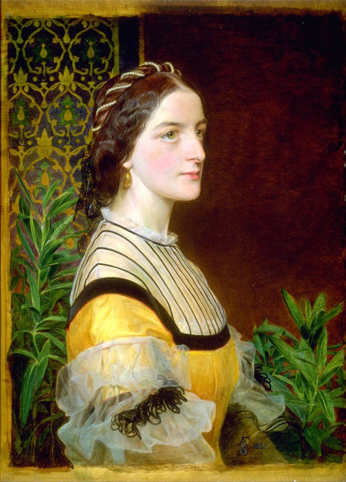
1860s portrait paintings from the united kingdom
university of michigan museum of art
19th-century portraits of men at bust length
fur collars in art
austrian prints in the albertina
lithographs by josef kriehuber
historical images of pontaix
château de pontaix
portrait paintings in the hungarian national gallery
portraits as sappho
august malmström
1860 paintings
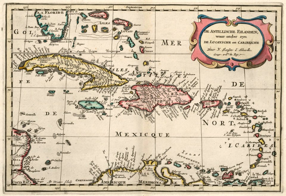
18th-century maps of puerto rico
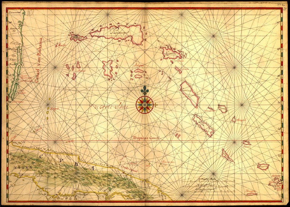
18th-century maps of cuba
prints from bonne atlas de toutes les parties at the peace palace library
1780 maps of canada
old maps of mexico
pictorial maps
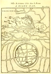
french-language maps of china
changzhou
fonds ancely - bibliothèque municipale de toulouse - maps
victor levasseur - maps of france
old maps of pernambuco
1665
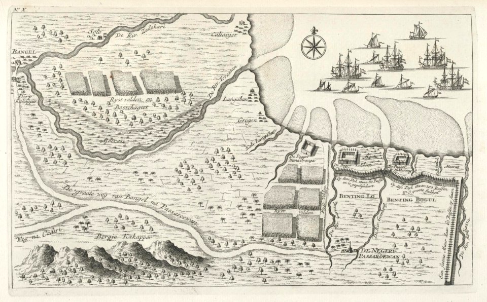
maps of the dutch east india company - indonesia
maps of east java
prints from dankaerts historis at the peace palace library
maps by johannes janssonius
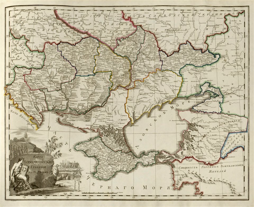
old maps of the sea of azov
old maps of crimea
maps with cartouches
atlas van der hagen
maps in musée de la compagnie des indes
maps of lorient
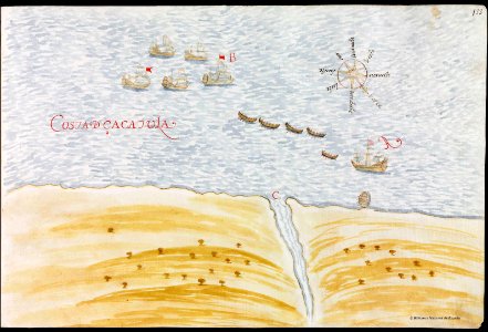
16th-century maps of brazil
old maps of africa
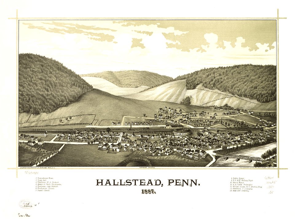
pennsylvania
hallstead
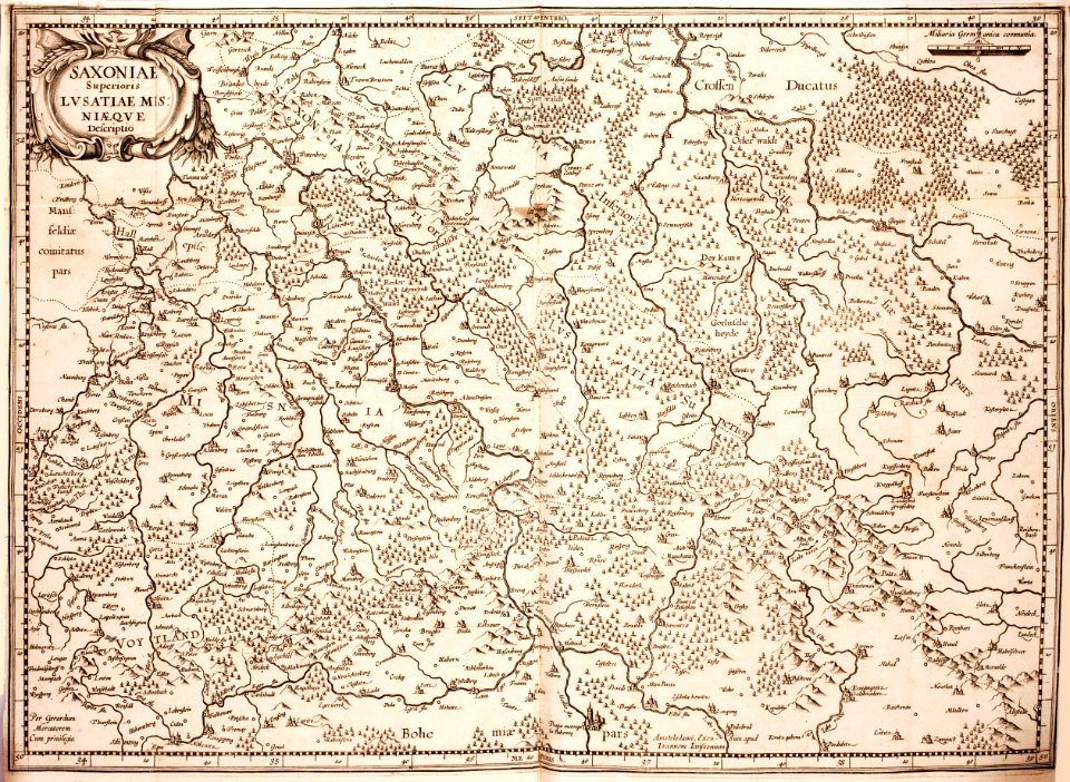
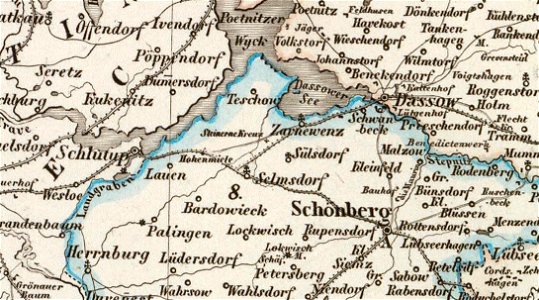
old maps of mecklenburg
maurin
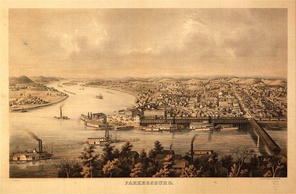
new york
hunter
maps in the library of congress
1650 maps
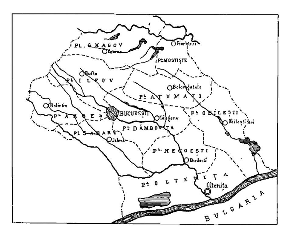
history of oltenița
ilfov
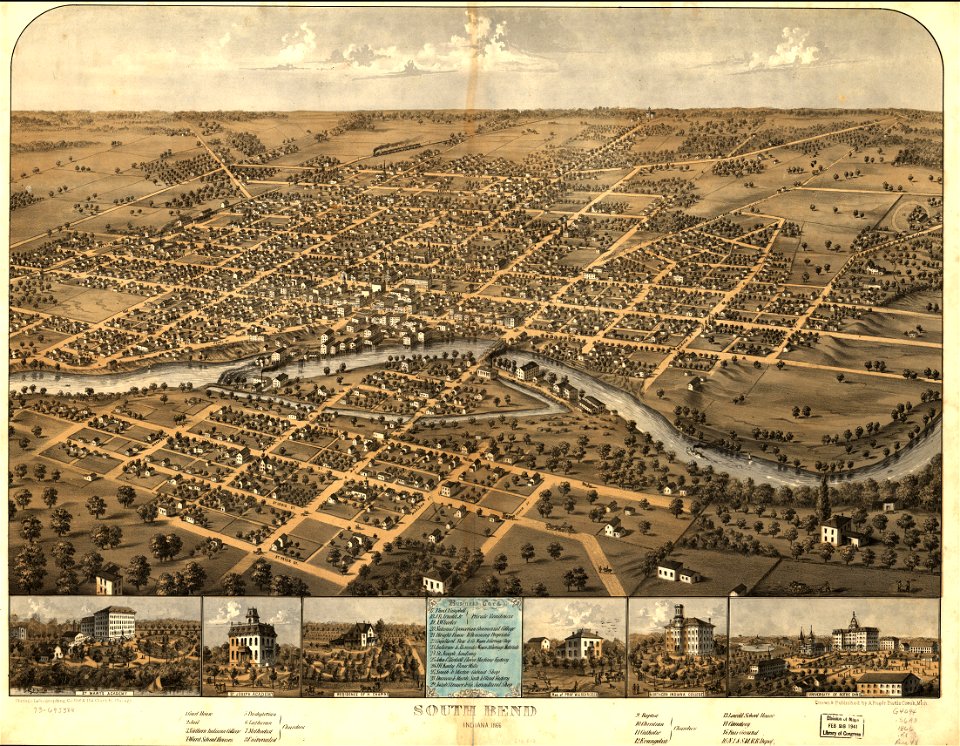
south bend
indiana
maps in the library of congress
maps by matthäus seutter
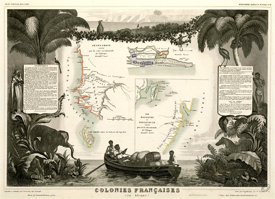
victor levasseur - maps of the world
old maps of senegal
old maps of massachusetts
massachusetts
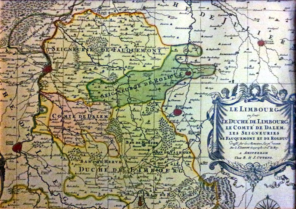
netherlands
limburg
dutch 17th-century prints in the rijksmuseum amsterdam
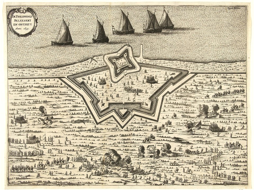
old maps of the philippines
copper engraving
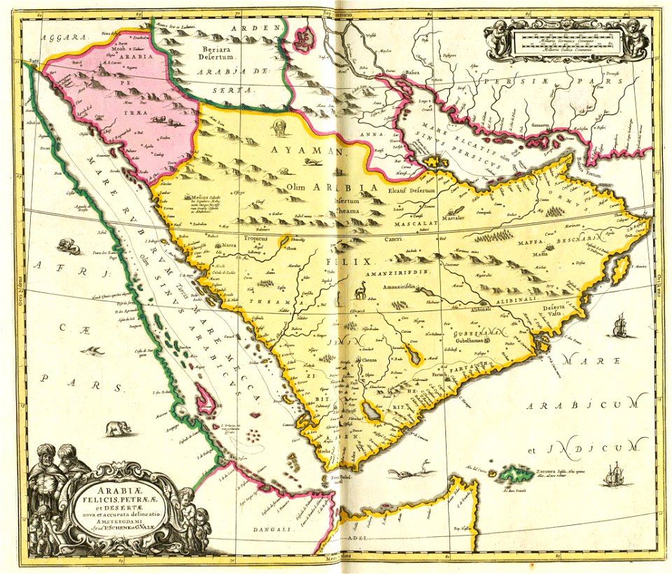
gerard valck
animals
india
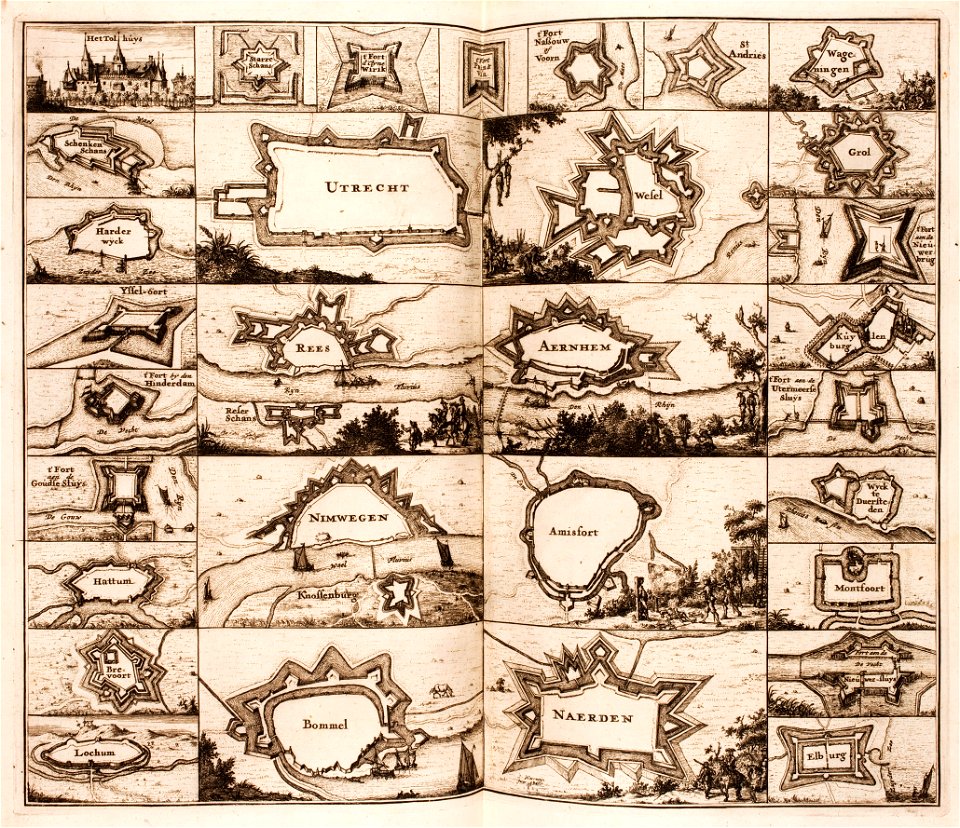
elburg
wesel
historical images of luxembourg palace
jardin du luxembourg
maps of paris in the 16th century
ludovico ariosto
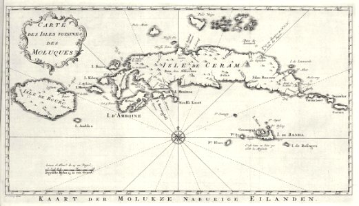
maps of the dutch east india company - indonesia
banda islands
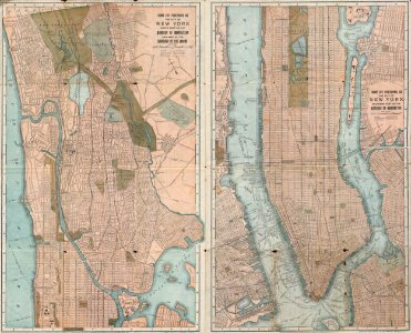
old maps of manhattan
new york city
old maps of earth's hemispheres
french-language maps
3601 - 3700 of 38,207
Next page
/ 383